How Does Surface Temperature Vary?
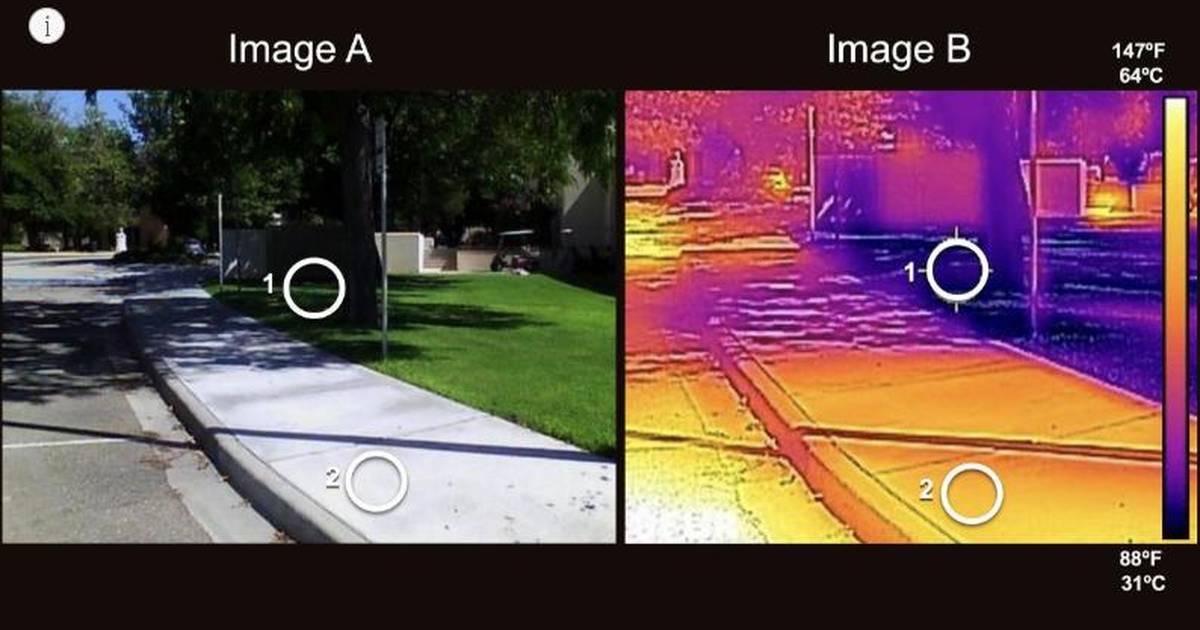
Urban heat islands can create temperature differences of up to 20°F within the same city. This NGSS-aligned lesson uses NASA satellite data, infrared imagery, and heat-mapping investigations to help students analyze urban climate patterns, interpret environmental data, and design engineering solutions that reduce heat risks in vulnerable communities. Explore more resources and continue your journey in the Investigating Heat Islands pathway.
Related resources
Topics
- urban heat island
- surface temperature
- infrared imagery
- Landsat satellites
- climate literacy
- heat mapping
- environmental data
- albedo
- land cover
- thermal energy
- remote sensing
- environmental justice
- urban climate
- temperature variation
- engineering design
- climate adaptation
- heat index
- GIS mapping
- sustainable cities
- tree canopy
- cool pavements
- public health
- extreme heat
- Earth observation
- satellite data
- climate science
- weather hazards