The Role of GIS in the Deepwater Horizon Oil Spill
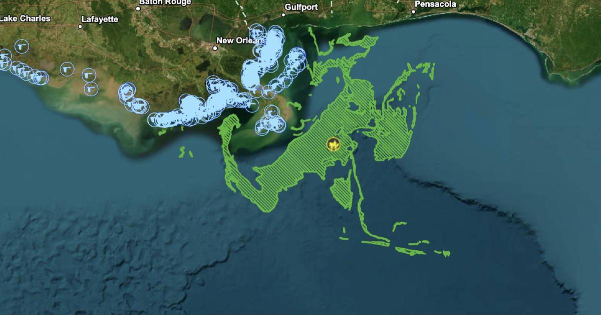
When disaster strikes at sea, how do we track something as vast as an oil spill? This case study explores how GIS and satellite data helped detect, track, and predict oil movement during the Deepwater Horizon spill—and how these tools support disaster response, environmental protection, and damage assessment.
Topics
- deepwater horizon
- gis
- remote sensing
- oil spill
- environmental disaster
- satellite imagery
- modis
- sar
- trajectory modeling
- gnome
- noaa
- oil slick tracking
- environmental protection
- marine pollution
- disaster response
- coastal impact
- oil spill detection
- gulf of mexico
- geospatial analysis
- ap environmental science
- ngss
- environmental monitoring
- ocean modeling
- environmental science